Maps
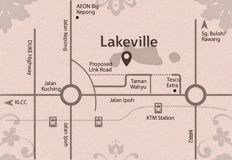
Lakeville Jalan Sibu Taman Wahyu Location Map
Lakeville at Jalan Sibu Taman Wahyu near the Jalan Ipoh road. Lakeville rising above a lush 12.38-ace green area, every unit in each of the 40-storey towers is like having an elevated semi-D; a Boutique Sky Semi-D, if you will. With built-ups from 978 sq. feet, this well-planned lay-out allows for energetic gatherings and quiet…
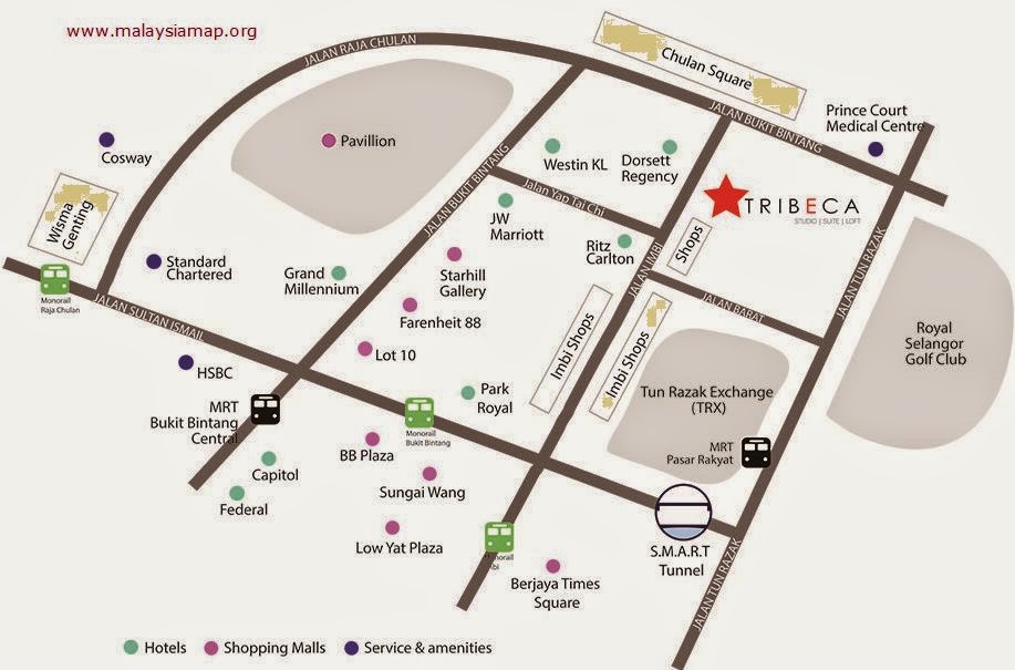
Read MoreTribeca Bukit Bintang Location Map
TRIBECA located in the heart of the retail/commercial hub of Kuala Lumpur, a stone’s throw away from the “Golden Triangle”. TRIBECA’s central location offers its residents a spectacular view of the city skyline. Overlooking the rolling greens of Royal Selangor Golf Club on the east, and the bustling commercial hub of Bukit Bintang on the…
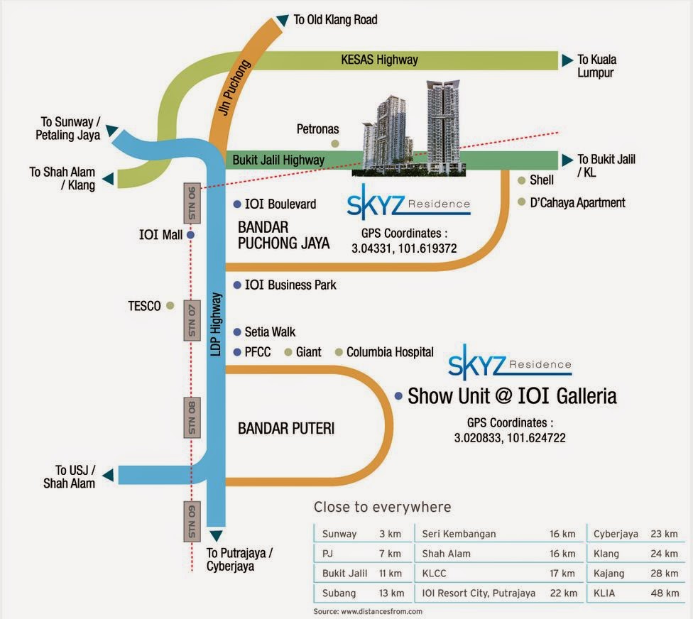
Read MoreSkyz Residence Bandar Puchong Jaya Location map
Skyz Residence resort condominium near the Bukit jalil highway. Close to everywhere 3KM to Sunway, 7 KM to Petaling Jaya, 11 KM to Bukit Jalil, 13 Km to Subang, 16 to Seri Kembangan, 16 to Shah Alam, 17 Km to KLCC. Also near to D’Cahaya Apartment. More info www.theskyz.com.my/ts
Read MoreMalaysia affordable properties location map
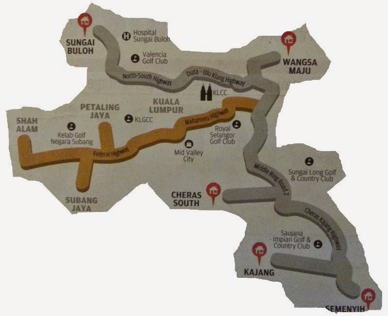
Finding affordable properties You may be eyeing that Mont’ Kiara condo in Kuala Lumpur but can’t afford to buy a unit. Why not look for a property in more hidden but affordable locations as indentified in these five hotspots? Sungai Buloh Wangsa Maju Cheras South Kajang Semenyih
Read MoreJalan Rawang, Georgetown, Pulau Pinang
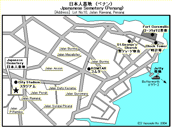
Japanese Cemetery Location map click for bigger view Jalan Burma, St George’s Church, Clock Tower, Fort Cornwallis, Jalan Macalister, Jalan Anson, Jalan Dato Kerama, Jalan Gurowara, Jalan Sungai Pinang, Jalan P. Ramlee, Jalan Rawang, City Stadium Link to : Georgetown
Read MoreBayan Lepas map peta in Penang
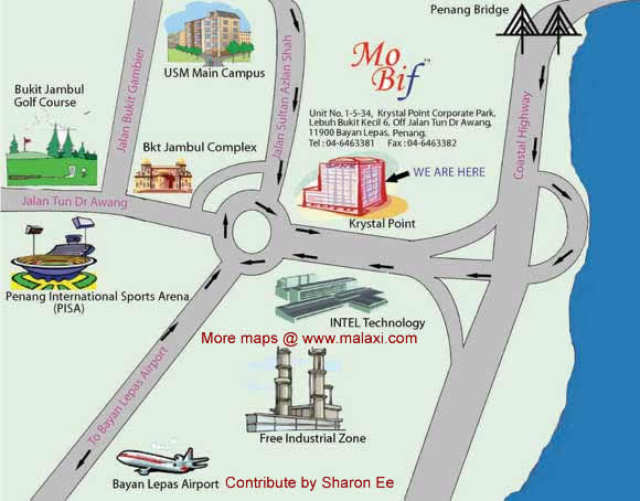
Click the map for bigger view Bayan Lepas map peta in Penang Bukit Jambul Golf Course, Bukit Jambul Complex, USM Main Campus, Penang International Sports Arena (PISA), Intel Techonlogy, Penang Free Industrial Zone, Bayan Lepas Airport, Krystal Point Road/Street: Jalan Bukit Gambier, Jalan Tun Dr Awang, Jalan Sultan Azian Shah,Coastal Hihgway, Penang Bridge
Read MoreCountry Heights Kajang map – Sri Banyan map peta
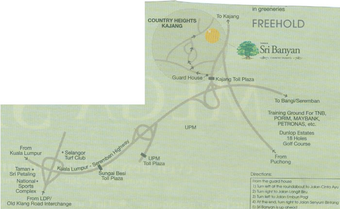
Taman Sri Petaling National Sports Complex Old Klang Road Interchange Selangor Turf Club Kuala Lumpur-Seremban Highway Sungai Besi Toll Plaza UPM Toll Plaza UPM Guard House Kajang Toll Plaza COUNTRY HEIGHTS KAJANG To Bangi/Seremban Training Ground For TNB, PORIM.MAYBANK, PETRONAS,etc. Dunlop Estates 18 Holes Golf Course
Read MoreJalan kasar map peta
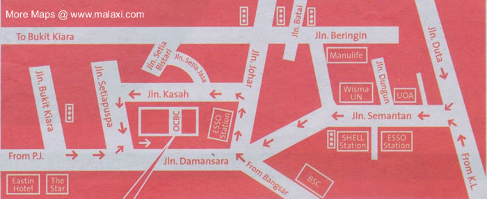
To Bukit Kiara, Jalan Batai, Jalan Beringin, Jalan Bukit Kiara, Jalan Setiapuspa, Jalan Kasah, Jalan Setia Bistari, Jalan Setia Jasa, Jalan Johar, Jalan Semantan, Jalan Duta
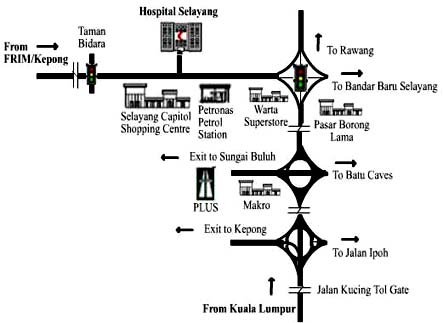
Read MoreHospital Selayang location map
To: Rawang, batu caves, Kepong, jalan ipoh, Kuala Lumpur, Sungai Buluh Selayang Capital Shopping Centre, Warta Superstore, Pasar Borong Lama, Hospital Selayang, Pasar Borong Lama
Read MoreSelayang map – Persatuan Buddhis Selayang
To: Batu Caves, Genting Highland, Kuantan, Kepong LDP Selayang mall, kepong, Taman Selayang Baru, Warta Baru, Pasar Borong Lama Selayang, Bandar baru selayang gombak land office, Pasar Borong baru,
Read More
