| Main > Kuala Lumpur > Puchong |

Puchong Map |
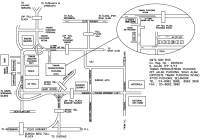
From / To :
Puchong to Klang, Puchong to Kajang Serdang, Puchong to Putrajaya and Cyberjaya, Puchong to Mines Seremban, Sungai Besi, From Shah Alam, from Puchong, from subang, from Kuala Lumpur
Road / Street :
Jalan Puchong, Jalan Klang Lama, Jalan USJ 9 Terrence House map,Jln USJ map, Persiaran Kewajipan map , Jln USJ 9/5M
Shoppoing Mall / Complex map / Hypermarket/ Leisure:
Tesco map, IOI Mall map, Giant map, Bandar Sunway map
Highway map :
KESAS highway map, Damansara - Puchong expressway ( LDP ), Federal Highway, Elite Highway
Puchong College map :
Binary College map
Resident map :
Bandar Puchong Jaya, , Taman Sunway Utama, Bandar Puteri, Tractors Malaysia, Tropika, Taman Puchong Hartamas, Taman Puchong Perdana map, Taman Puchong intan, Pusat Bandar Puchong Utama, Taman Puchong Utama, Bandar Bukit Puchong map.
Office map :
Tractor Malaysia map, IOI Business Park map, Taman Industry Puchong TPP1 TPP5 map, Motorola map, National air-cond map
Toll map :
Sungai Besi Toll Plaza map, KESAS toll plaza map, LDP toll plaza Bandar Sunway map, LDP toll plaza puchong barat map, toll plaza USJ map,
|
More Maps
Saujana Puchong Map
Lestari Puchong map
 Puchong Life Style Puchong Life Style
 Puchong New Puchong New
 Puchong Business Directory Puchong Business Directory
 Puchong Classifieds Puchong Classifieds
|
|
|

Puchong Map
|
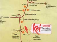
From / To :
From Shah Alam, from Puchong, from subang, from Kuala Lumpur
Road / Street :
Jalan USJ 9 Terrence House map,Jln USJ map, Persiaran Kewajipan map , Jln USJ 9/5M
Shoppoing Mall / Complex map / Hypermarket:
Tesco map, IOI Mall map
Highway map :
Bukit Jalil Highway map
Resident map :
Bandar Puchong Jaya, , Taman Sunway Utama, Bandar Puteri, Tractors Malaysia, Tropika, Taman Puchong Hartamas, Taman Puchong Perdana, Pusat Bandar Puchong Utama, Taman Puchong Utama, Bandar Bukit Puchong map.
Office map :
IOI Business Park map |
|

Puchong Map
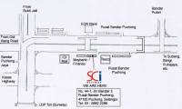
Map provide by Poh Chong Howe |
From
from Bukit Jalil, from old Klang road, to Subang bangi, to Putra jaya, to Sunway
Road / Street :
Jalan USJ 9 Terrence House map,Jln USJ map, Persiaran Kewajipan map , Jln USJ 9/5M
Shoppoing Mall / Complex map:
Tesco map, IOI Mall map
Highway map :
LDP Highway map, Kesas highway map
Restorance map :
Tai Tong Restorance map.
Office map :
Pusat Bandar Puchong map, bandar puchong jaya map |
|

Puchong Map
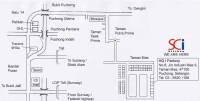
Map provide by Poh Chong Howe |
From
to Bukit Jalil, to Dengkil, from Sunway, from federal highway
Shoppoing Mall / Complex map:
Tesco map, IOI Mall map
Highway map :
LDP Highway map, Kesas highway map
Office map :
Pelikan map, DHL map, tractors malaysia map
Resident map
Taman Putra Prima map, Taman Tasik Prima map, Bukit Puchong, Puchong Utama, Puchong Perdana, Puchong indah, Bandar Utama map, Taman Mas map |
|
Puchong Story
Surrounded by a highly interwoven network of highways, Puchong is accessible using LDP highway, KL-Seremban highway and KESAS highway.
Subang Jaya, Kinrara, Petaling Jaya and Shah Alam are neighbourhoods that help to facilitate and integrate the demands and wants of residents and visitors of Puchong.
For those staying around puchong area, there are new chinese restaurants/shops opening business in newly built buildings in Puchong jaya, the area where all the banks are and which is just opposite IOI mall.
It has become a food paradise due to the large number of chinese eateries. |
|
 Puchong Map - Location map cover area map, street directory map, road map


