 Melawati Location Map

|
|
| Home > Kuala Lumpur map > Melawati map | |
|
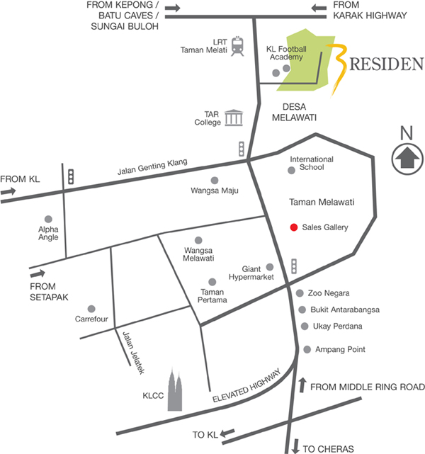
About Melawati Melawati Township This township has an easy accessibility to the newar city centre via the Ampang-KL elevated highway, MRR2 to KLIA, Putrajaya & Cyberjaya & the DUKE highway. Also nearby are ecuational institutions such as KL International School, Sri Inai, International Islamic University & UTAR and amenities such as Carrefour, Giant and Alpha Angle.
From: Kepong, Batu Caves, Sungai Buloh, Karak Highway, Middle Ring Road To: KL, cheras KL Football Academy, Desa Melawati, TAR College, International School, Wangsa Maju, Alpha Angle, Taman Melawati, Sales Gallery, Wangsa Melawati, Taman Pertama, Zoo Negara, Bukit Antarabangsa, Ukay Perdana, Ampang point Road Street: Jalan Genting Klang, Highway: Elevated Highway |
Information Search here
rightmenu

Custom Search
rightbottom |
Power By Entertop.net